


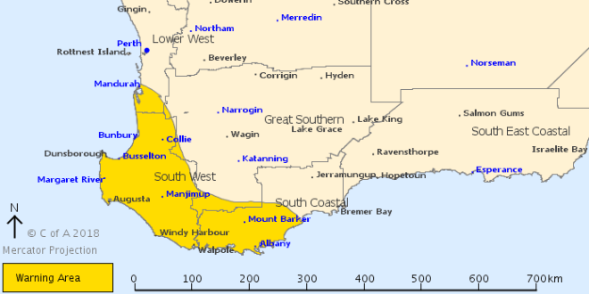
A severe weather warning remains in place.
A severe weather warning has been issued for residents in the South West and parts of the Lower West & South Coastal districts.
Damaging winds may continue during Thursday in the wake of a cold front southwest of Mandurah to Bremer Bay.
Heavy rainfall is expected to ease on Thursday morning.
The cold front will continue to move east during the remainder of Thursday, with a cold and showery southwesterly flow continuing in the wake of the front.
Thunderstorms and small hail are possible over the southwest of the State until early Friday morning. Winds and rain areas will ease from the southwest during Thursday morning.
Mandurah measured 7.8mm of rain on Wednesday night, with wind gusts up to 74 kilometres per hour.
Heavy rainfall over parts of the warning area and may continue over eastern parts for the next few hours and may cause flash flooding.
Main Roads reported flooding over the Kwinana Freeway at the South Terrace off ramp and at Canning Highway.
As the cold front moves east, cold and showery conditions will continue over southern and western parts of the State, with thunderstorms and small hail likely until early Friday morning.
The Department of Fire and Emergency Services said residents should prepare their homes for heavy rainfall.
MANDURAH FORECAST
Friday August 10 Min 7, Max 15. Early shower or two. 0 to 2mm
Saturday August 11 Min 7, Max 15. Mostly sunny. 0mm
Sunday August 12 Min 8, Max 18. Sunny. 0mm
Monday August 13 Min 12, Max 20. Shower or two developing. 1 to 4mm
Tuesday August 14 Min 12, Max 17. Showers. 2 to 4mm
Wednesday August 15 Min 10, Max 15. Shower or two. 0 to 1mm
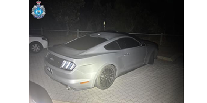 Stolen Ford Mustang linked to southern suburbs incidents
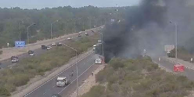 Baldivis: Truck fire forces closure of Kwinana Freeway
 Concerns for missing Baldivis girl
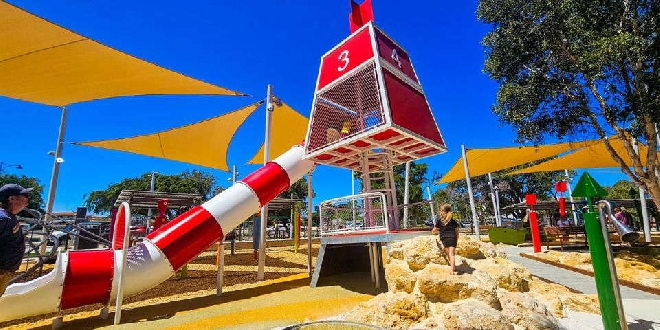
 MARC leisure pool, pirate playground to close for several weeks due to maintenance works
 Petition launched to change new Eastern Foreshore playground due to safety concerns
 Parts of Pinjarra, Fairbridge without power
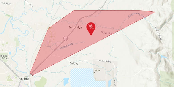
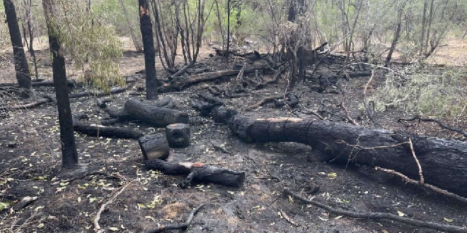 Bouvard scrub fire deemed suspicious
 Peel Thunder crush Perth in WAFLW season opener
 Baldivis man charged after AFP seize haul of cigarettes, vapes, $2.6M cash